I have been near close to the Mississippi river .......it is a bad motherfucker .........when it comes to rivers .........i heard it flowed backwards one time .......it is a dangerous deep river ....and bet your barnacles....... to a banjo playing contest at a country fair .......there are many...... many....... dead carcasses in there .....its deep....... and dark ....and it is powerful ......there is no way i would like to live in........ and around ........the Mississippi river....... ever .....but some people are trapped....... they have family homes....... and suchlike bollock...... material possessions ...... they have to worry about ....no sirreeee!!!!!!bob ,......not i .....fuck that ......a river that big ....it runs for hundreds of miles ......personally i think it is mother natures way of paying us back ....well not me personally !!!!!!! ....as i live no where near that fucking behemoth .......but i think it is karmic payback of all the shit ........we as humans are doing to the big rock ......you have to play .....for the games you play ....always .......
Surge of high water to escalate flooding concerns on rivers across north-central US

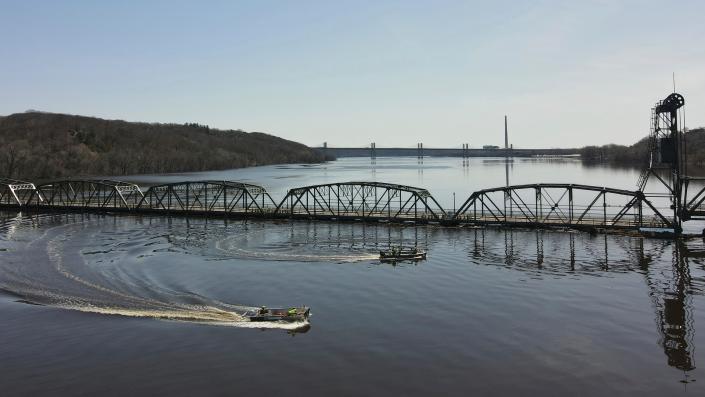


The upper portion of the Mississippi River, as well as the Red River and others in the north-central United States, will experience major flooding into this week, AccuWeather meteorologists warn. The surge of high water will slowly progress southward along the Mississippi in the coming weeks.
AccuWeather's long-range forecasters have been sounding the alarm for the likelihood of significant spring flooding since early this winter due to anticipated heavy snowfall as well as the risk of rain events that would accompany the spring thaw.
Even though record-high levels are not likely on most of the rivers, there will still be significant impacts due to major flooding along hundreds of miles of waterways.
 |
The long-range team, led by Senior Meteorologist Paul Pastelok, has insisted that while water levels may be contained by most levee systems during this spring's flooding, unprotected regions, such as farmland and small rural communities, could suffer the most.
- ADVERTISEMENT -Flat terrain in the region causes the streams and rivers to flow more slowly than in hilly terrain. Not only does the flooding cycle take much longer to progress when compared to a mountainous region, but vast stretches of water may persist in areas that drain poorly for days and weeks.
Some locations along the large rivers, such as the upper portion of the Mississippi and the Red River, could remain in major flood for a week or more and above flood stage for close to a month.
These conditions may prevent access to agricultural areas and may cause some roads to remain impassable for an extended period this spring.
Bismarck, North Dakota, and Minneapolis are both experiencing a top three-snowfall season. With more chances for snow likely this spring, the snowfall amounts could end up being the heaviest on record. Duluth, Minnesota, is now experiencing its snowiest season on record as it recently surpassed the 135.4-inch mark set in 1995-1996.
 |
Much of the snow from the winter season has melted as well as a recent burst of heavy snow that brought 1-2 feet in Wisconsin and eastern Minnesota the weekend before last. The melting has already set into motion a major flooding event for portions of the Dakotas, Minnesota, Iowa and Wisconsin due to rising waters on area rivers.
Those rivers include the Minnesota, Crow, St. Croix, Red River of the North and the upper portion of the Mississippi.
At least 36 gauge locations across rivers in the north-central U.S. were forecast to hit major flood stage, including numerous locations on the Mississippi and Red rivers, according to the National Weather Service.
The melting process of the winter snowpack has been gradual enough to avoid a worst-case scenario along the Red River, including the Fargo, North Dakota, area. The heavy snow that fell early last week largely avoided the Red River basin.
Fargo Mayor Tim Mahoney told AccuWeather that the city deals with a "major" flooding event every four to five years, and officials are busy preparing for this year's flooding. Mahoney said that original projections by the National Weather Service of a 38-foot crest on the Red River would be serious, but due to a more gradual thaw that has unfolded, the river crested just shy of 30 feet on Saturday and has been manageable.
 |
Major flood stage at Fargo is 30 feet. Record-setting flooding occurred in the city back in 2009 when waters reached 40.84 feet.
Major flooding is a concern all the way along the Mississippi River to areas south of the Quad Cities region in Iowa and Illinois in the next couple of weeks, according to AccuWeather Senior Meteorologist Matt Benz.
A top-three crest is projected for the Mississippi River at LaCrosse, Wisconsin, and Dubuque, Iowa. Water levels are expected to reach within 2 feet of the record at both locations, which are 17.89 feet and 26.81 feet, respectively. Both record floods occurred in April 1965.
 |
"How high the Mississippi River gets from places such as Dubuque, Iowa, on south will be greatly dependent on the amount of moisture that is injected into the river system over the next one to two weeks," Benz added.
The level and timing of crests are subject to adjustment and may change significantly as rainstorms, rapidly melting snow and freezes affect the region. Typically, National Weather Service hydrological data from rainfall and runoff are highly scrutinized out to about 48 hours. Specific forecasts for river levels extend out for a week or more with long-term estimates and probabilities that extend out for a few months.
"There are a number of locks and dams along the upper Mississippi River between La Crosse, Wisconsin, and Davenport, Iowa, with some big pools that can hold some water back," Benz said. "The mitigation measures have likely captured some of the local spring melt up to (last) week, but these locations may need to discharge more water as the surge comes down from the north in the next couple of weeks."
High, fast-flowing water may inhibit barge traffic from above St. Louis to near St. Paul, Minnesota, over the next few weeks.
 |
"As a result of the high water on the upper Mississippi and flooding of low-lying farms, roads and rail systems, there may be a significant economic impact on the region which could echo throughout the nation," Benz said.
Water levels remain very low along much of the Missouri River due to increasing drought over the southern and western portions of the watershed.
Waters have receded from minor flood stage, which was observed several weeks ago along much of the Ohio River.
Both the Missouri and Ohio rivers are the major tributaries to the middle portion of the Mississippi River. Unless heavy rain falls in these river basins at approximately the same time as the surge of water from up north arrives, the level of water rise in the middle Mississippi should be less extreme when compared to locations farther north in Iowa, northern Illinois, Minnesota and Wisconsin.
Several storm systems with episodes of rain and dryness are likely to affect the region from late April to the first part of May, Pastelok explained.
 |
"This storm track represents a bit of a pattern flip from recent weeks and months with the bulk of the storms avoiding the northern tier of the Central states," Pastelok said. "The intensity of these systems and the amount of rain they bring over the middle and lower portion of the Mississippi River basin will be monitored closely for potential add-on flooding problems."
Near and below where the Ohio River joins in around Cairo, Illinois, the width of the Mississippi River broadens significantly - and the volume of water that it can handle increases substantially.
Historically low water levels along much of the Mississippi and Ohio rivers from last summer to the start of this past winter greatly hindered and in some cases forced a stop to the transport of goods and grains via barge.
The period of high water along the Mississippi River in areas north of the Ohio River may last well into May. It could take until late May for the surge of water and perhaps minor flooding issues to reach the lowest portion of the Mississippi.
Want next-level safety, ad-free? Unlock advanced, hyperlocal severe weather alerts when you subscribe to Premium+ on the AccuWeather app. AccuWeather Alerts™ are prompted by our expert meteorologists who monitor and analyze dangerous weather risks 24/7 to keep you and your family safer.


No comments:
Post a Comment